Southwest Trip -- May 9-27, 2003
![]()
![]()
![]()
![]()
![]() This trip is rated 5 boots out of 5 on the
Hiking Boot-o-meter.
This trip is rated 5 boots out of 5 on the
Hiking Boot-o-meter.
Go here for The Pre-Trip Planning Page
Trip Vital Statistics
| Total Hiking Mileage | 105 Miles |
| Total Road Mileage | 3996 Miles |
| Total Dirt Road Mileage | 184 Miles |
| Best Dirt Road | Cathedral Valley Loop |
| The 'Loneliest Highway in America' | Highway 50 from Ely, Nevada to I-15 in Utah, to be known henceforth as "Sue's Shortcut" |
| Highest Momentary Speed of the Trip | 97 MPH - passing a truck on Highway 93 in Nevada on the way home (with 'Lead-foot' Sue at the wheel) |
| Highest Sustained Speed of the Trip | 92 MPH - trying to catch up with Jack and Ruth on the way to Hite Marina on Highway 95 after we stopped at Fry Canyon |
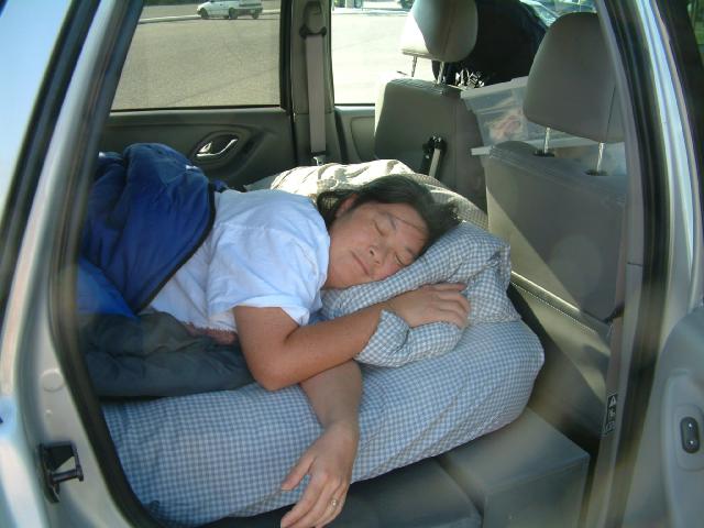
Sue sleeping in at the Motel Mazda at the I-84 Rest Stop in Ontario, Oregon. That's her (feet first) over on the left. Somebody really didn't want to get up and hit the road.
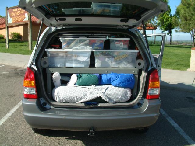
A look inside our suite - thanks to Diane the seamstress for her linen-sewing efforts.
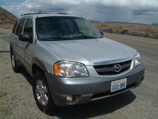
Here is our nice clean Mazda sporting its new bold, but discreet, dorsal fin. Zoom-Zoom-Zoom.
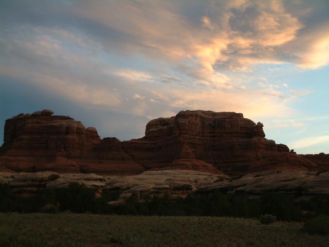
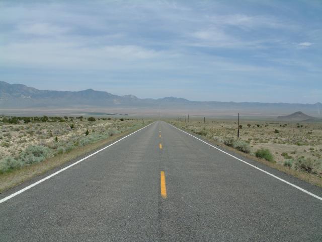
We had a wonderful drive down Highway 93 in Nevada - one of our favorite roads, especially since it leads to Southern Utah and the Red Rocks. Sue decided that we should take a shortcut - Highway 50 from Ely, Nevada to I-15 in Utah. We finally arrived at the Goblin Valley State Park campground at 11:20 PM, where we quietly set up camp.
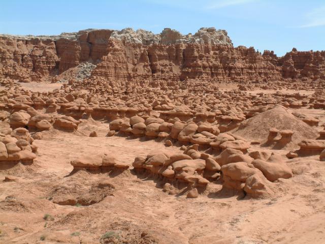
The next morning we wandered around Goblin Valley, and spent a good bit of the afternoon driving up to I-70 and back on a wonderful dirt road (Exit 129 on I-70; the road parallels I-70 to the west for a ways, then turns south). Since we drove I-70 after dark the night before, we took this opportunity to head west to...
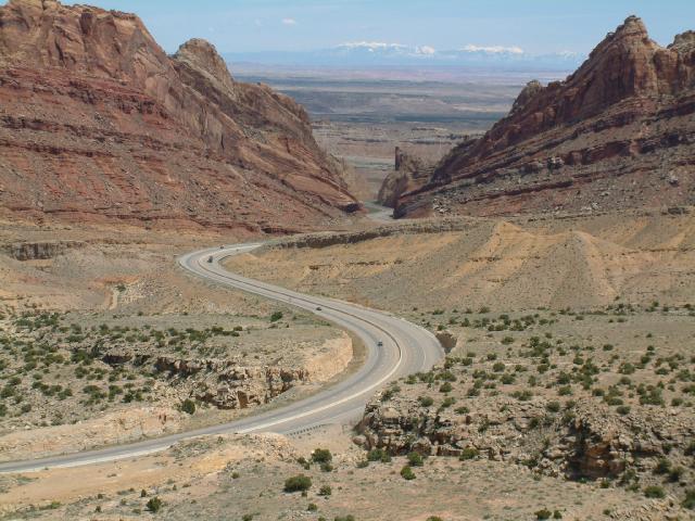
the primo viewpoint on I-70. It's at mile post 142 eastbound, near all the brakeless truck escape ramps. After cruising I-70 for a bit, we headed back to Goblin Valley.
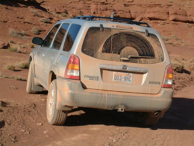
Here is our nice dirty Mazda sporting its new discreet, but bold, dorsal fin. Zoom-Zoom-Zoom.
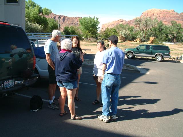
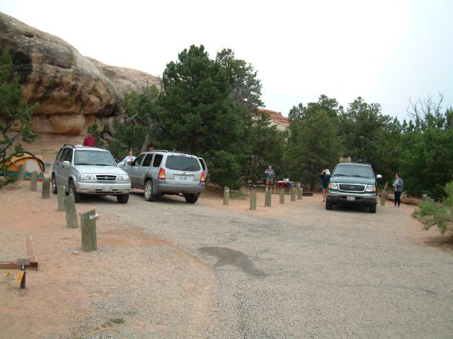
When we got back to the campground we were pleased to see that Jim and Carol had arrived and were waiting for us.
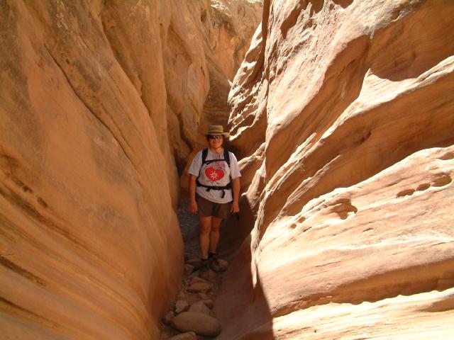
We all went hiking up Little Wild Horse Canyon and then down Bell Canyon.
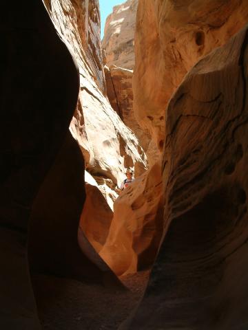
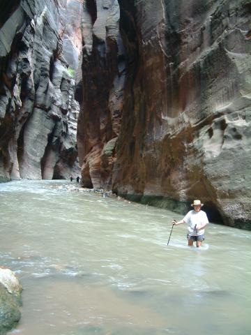
Here is Sue hiding in Little Wild Horse Canyon. After some heat-related problems, we decided to bail out of the rough stuff and headed for a night of recovery at the Motel 6 in Green River. After a comfortable night, we headed east on I-70 to our favorite 'ghost town' of Cisco, then drove down along the Colorado on SR-128 to Moab.
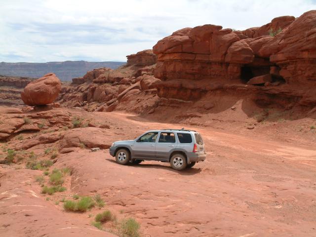
We drove up the Potash Road, hoping to get all the way up to the Island-in-the-Sky District of Canyonlands National Park, but decided to turn around when the road got a bit too rough for our taste.
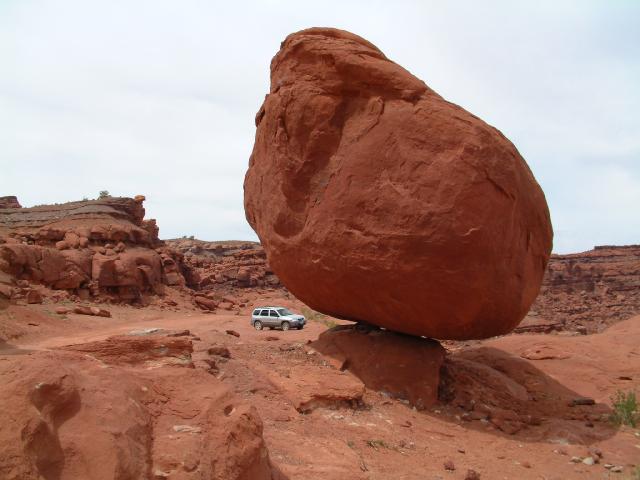
We narrowly escaped this giant balanced rock which started rolling and ended up right where we had been parked only scant moments before.
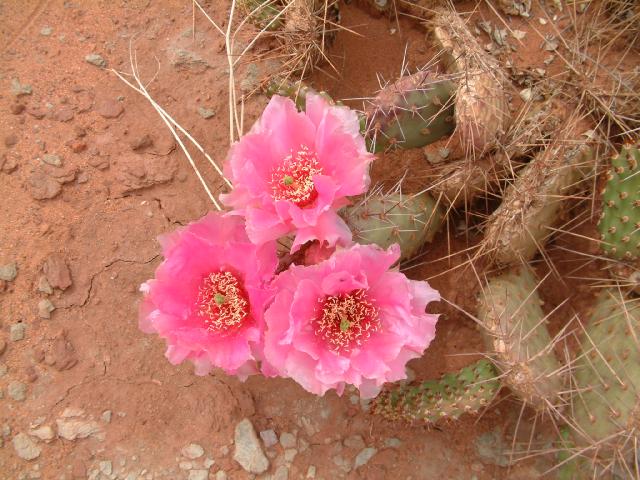
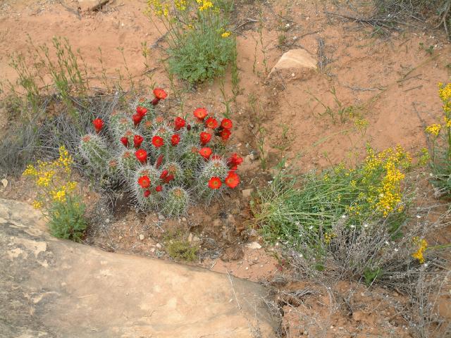
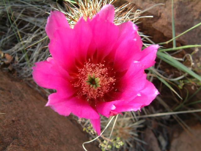
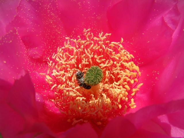
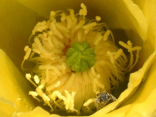
Some of the cactus flowers were at their peak.
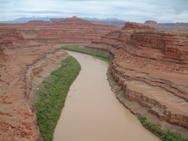
We got as far as the big Colorado River meander, where we weenied out and headed back, deciding that next time we would rent a Jeep in Moab and beat up someone else's vehicle.
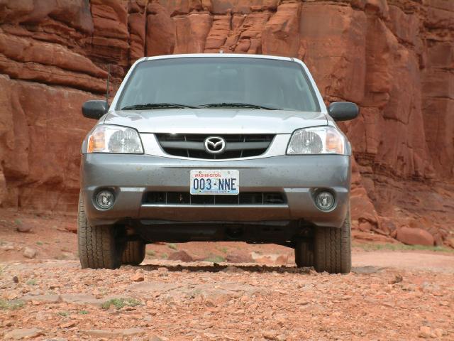
Note the very tip of the subtle, yet aggressive, dorsal fin looming over the roof.
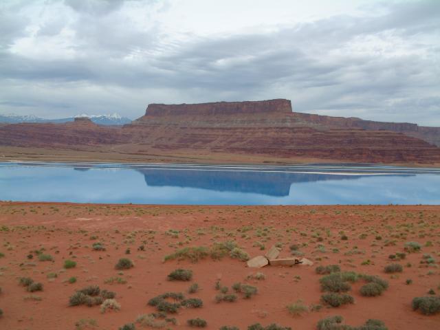
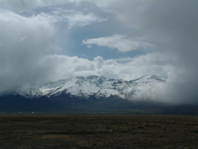
We went right by the huge potash evaporation ponds. The snow-capped La Sal Mountains can be seen in the distance.
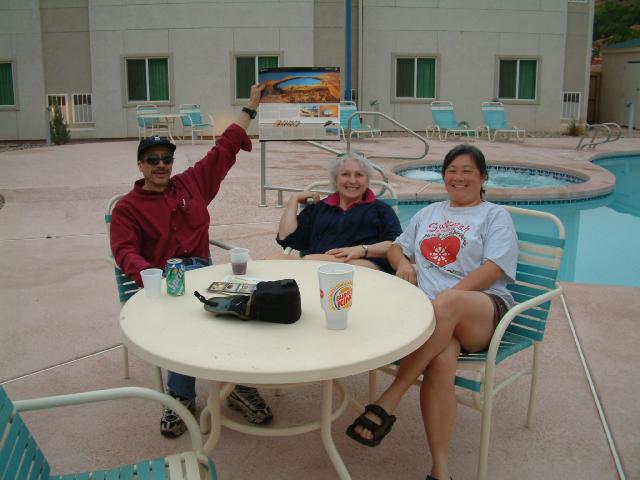
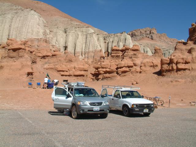
Frank and Diane were waiting at the Moab Motel 6, and we all waited around by the pool for Jack and Ruth and Jim and Carol. We gave up and went to the Teriyaki place, then did the requisite shopping.
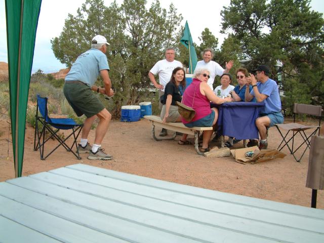
The next morning we decided that we would have breakfast in the Motel 6 parking lot for an added touch of elegance.
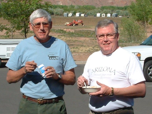
These two farmers abandoned their tractor in the South 40 and joined us for breakfast.
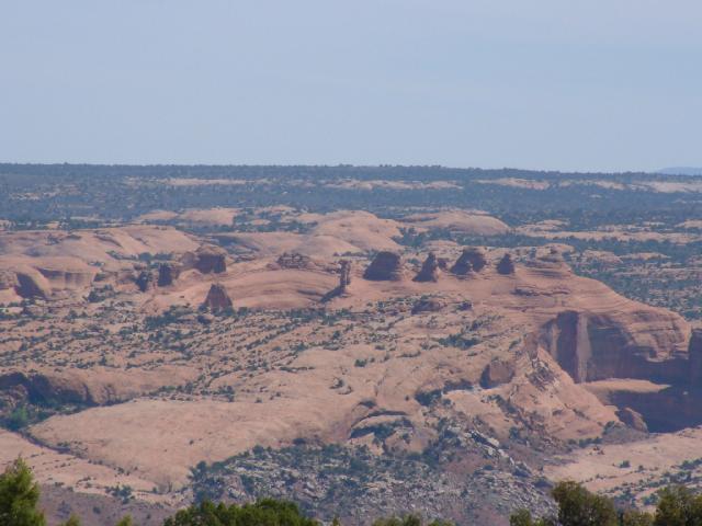
From Panorama Point, Delicate Arch can be seen edge-on in the distance.
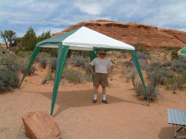
Unbeknownst to Jack, he was playing right into the hands of the Arizona Swami by erecting his new shade tent, as we were to find out a few days later during the 'Awards Ceremony'.
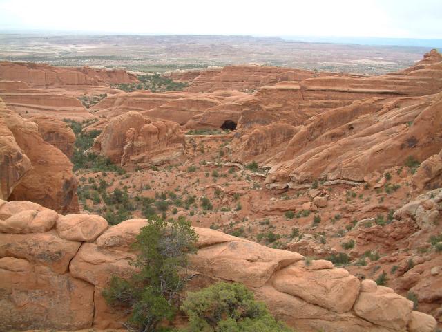
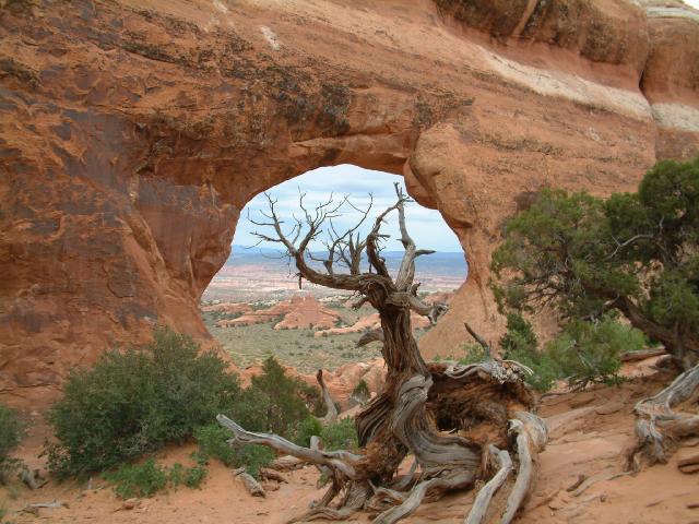
We decided to hike out to Double-O Arch along one of our favorite trails in Utah. Here is a view of Black Arch in the distance.
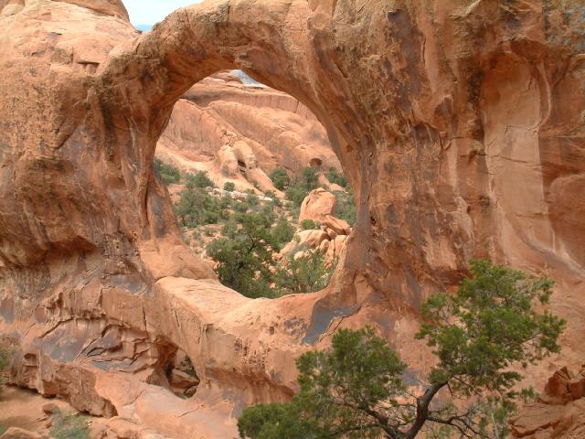
We got to Double-O Arch, where...
we met up with Frank and Diane, and sat around enjoying the view for a while, then hiked out to the Dark Angel spire where we had lunch.
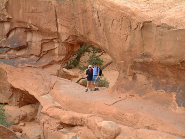
On the way back we stopped at a few more arches.
Ol' Jim seemed to have trouble keeping up with the rest of us once in a while.
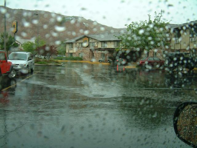
Fortunately, we had to re-charge the camera batteries, so we had no choice other than to spend the night 'motel camping', leaving the others at the Arches campground. The rain (so we were told by the campers) started at about 7:30 in the morning, but the weather steadily improved thereafter. We headed back to the Arches campground to check up on the hearty campers, then...
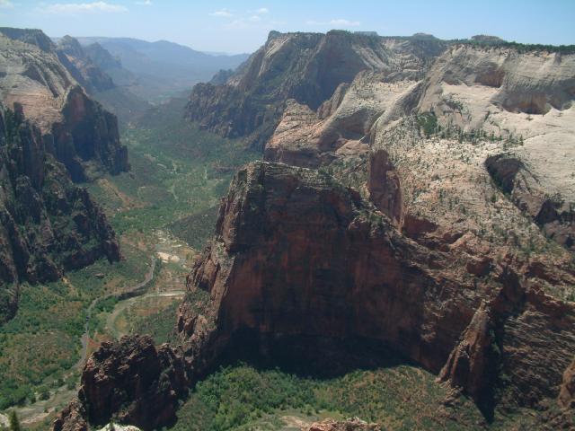
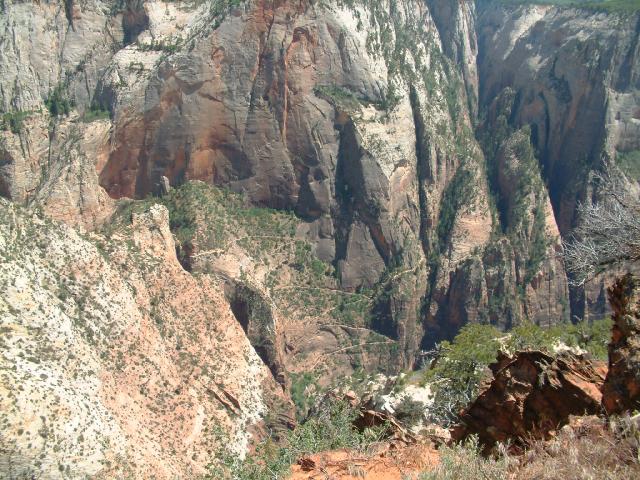
headed up to the Island- in-the-Sky District of Canyonlands National Park, and went on the Upheaval Dome Overlook hike.
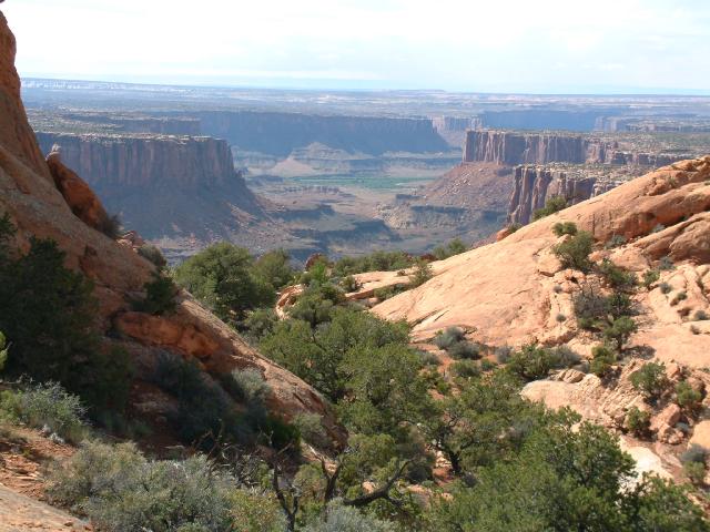
Looking down to the Green River, where we spent a night on the river bank last year during the ill-fated Upheaval Dome Circumambulation hike.
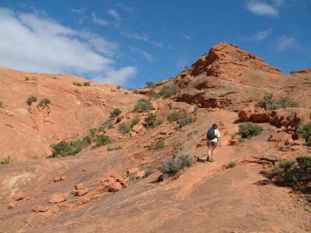
Sue reluctantly heads back to the car to conclude a wonderful hike. We were all going to meet at the Delicate Arch trailhead back at Arches and spend the evening enjoying the full moon (thoughtfully arranged by Ruth) over Delicate Arch. We hoofed up the well-worn trail...
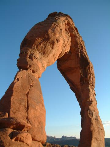
and all had a most pleasant time enjoying the arch and watching the sunset, and were delighted when we learned that Ruth had arranged not only a full moon, but also a full lunar eclipse, for our celestial entertainment.
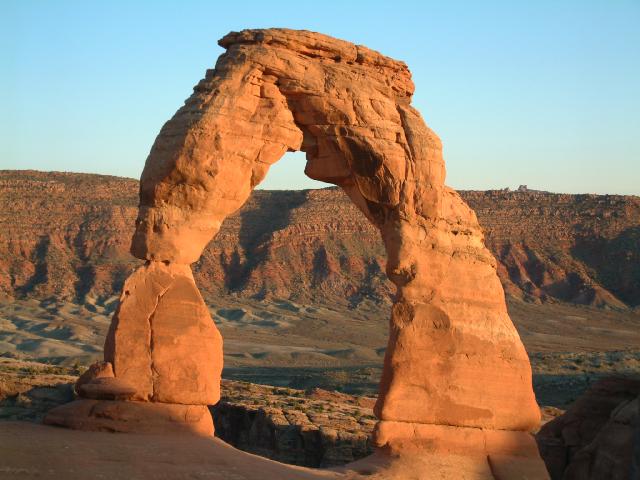
There is absolutely nothing else like it... anywhere.
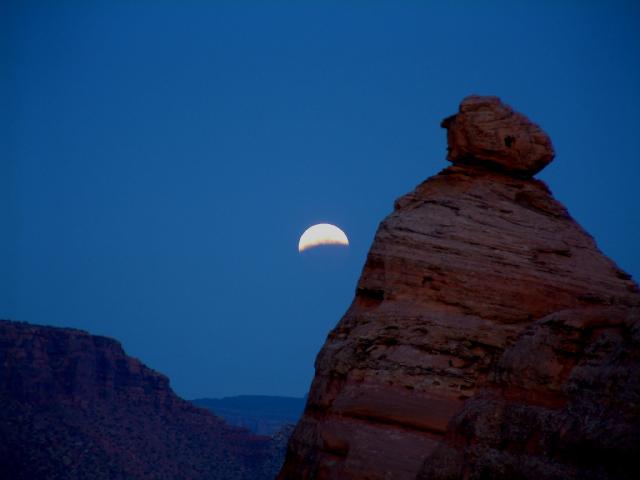
The moon was already partially eclipsed as it rose above the horizon.
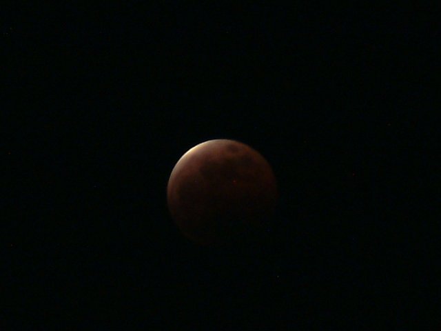
Just before the full eclipse. Jack and Ruth stayed up there after we all left and waited for the moon to un-eclipse. We had to take off and head to town to get a motel since we were going to meet up with Jim and Carol at 6:00 AM the next morning.
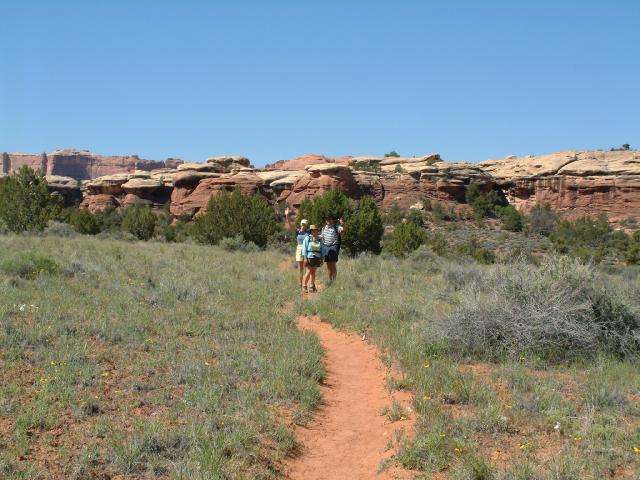
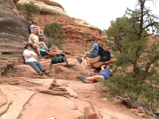
We actually got up while it was still dark, met up with Jim and Carol at 6:00 AM in the morning, and headed south to the Needles District of Canyonlands National Park to secure campsites for the next two nights. We lucked out and got two very nice adjacent campsites, then waited around for a while for our associates to show up, but they were still goofing off up in Moab, so we decided to go for a hike. Here we are starting out on the Big Spring Canyon / Squaw Canyon Loop hike.
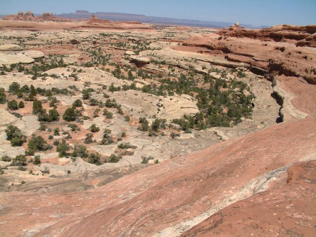
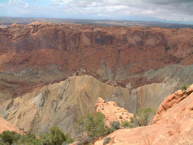
Looking down into Big Spring Canyon from the ridge that separates it from Squaw Canyon.
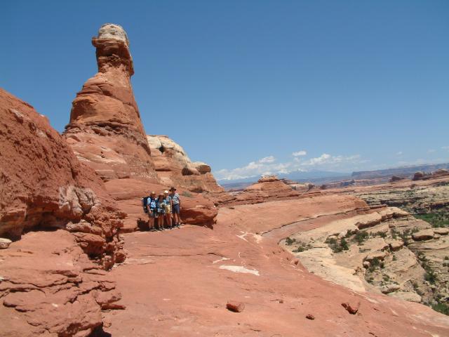
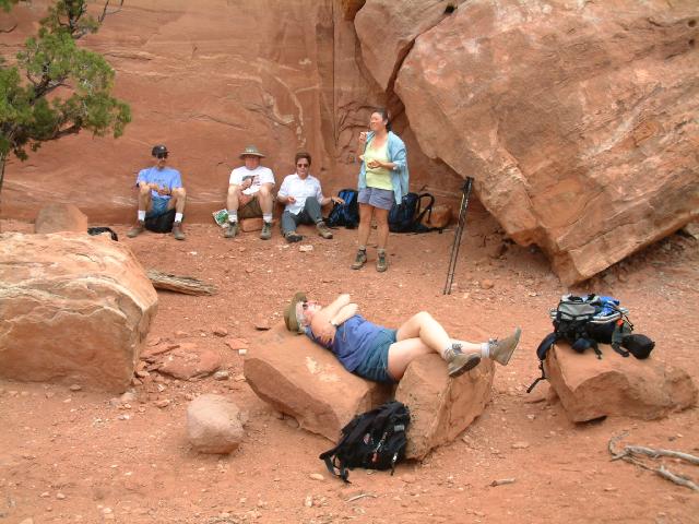
To the casual observer, the scene above would appear to simply be 4 hikers on the ridge between between Big Spring Canyon and Squaw Canyon.
But as shown below, looking at the same scene with the proprietary and almost magical 'Stuff Hidden in the Rocks Enhancement Feature' activated, even the most cursory glance reveals a plethoric array of, not surprisingly, Stuff Hidden in the Rocks:
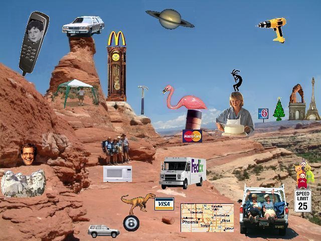
Here are a few hints:
a cell phone with Theodore Cleaver on the screen
the ubiquitous station wagon filled with camping equipment
a grandfather clock with a happy face and golden arches on top
a guy standing in a canopy/tent sort of thing
a claw hammer
Saturn complete with rings
a flamingo nesting atop the front stack of the Queen Mary sitting on top of a Master Card
Martha Stewart baking a cake while Kokopelli dances on her head
a Motel 6 sign
a fully decorated Christmas Tree
a flying Dewalt cordless drill
the Paris skyline with the Arc de Triomphe with the Arc de Delicate on top alongside the Eiffel Tower
4 hikers standing on top of a microwave oven
a FedEx delivery truck
the Teletubbies atop a speed limit sign
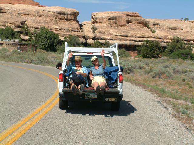
2 hikers hitching a ride in the back of a Chevy pickup truck
a street map of the Greater Phoenix, Arizona, Metropolitan area
oddly enough, a dinosaur standing on top of an 8-ball with a Visa card in its mouth
a silver Mazda Tribute SUV just like ours
Mount Rushmore including Wild Bill Clinton (look carefully on the right side)
David Letterman peeking out of a cave
How many can you find? If you need help, please consult with Carol, who is an acknowledged expert at 'seeing things in the rocks'.
Check back often since new stuff may periodically appear.
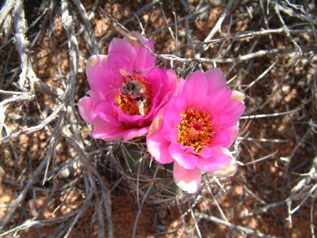
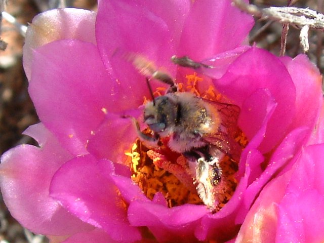
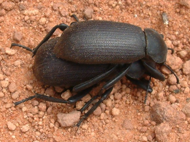
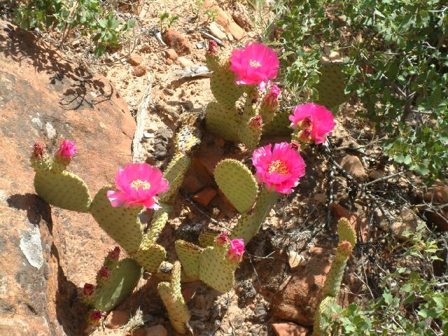
We finally started seeing some cactus blooms.
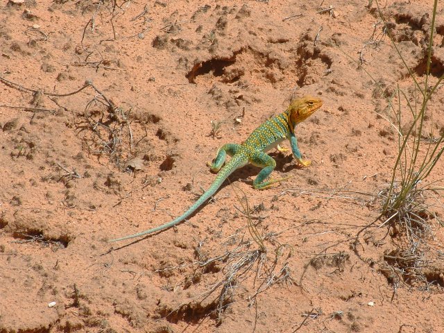
We watched this Collared Lizard wander around for a while.
Jim dashed ahead to the campsite where he picked up his truck and drove back to the trailhead and gave Carol and Sue a lift back to the campsite, while your humble writer walked the extra mile in the mid-day desert sun and heat.
It was Sue's night to cook dinner, and we settled in for a fun-filled evening around the campsite..
Yumm, yumm...
After dinner we convened atop a local rock for another session with the Arizona Swami and his lovely assistant, and collectively marveled at the mystical revelations presented thereat. The next morning we had to sadly say 'Farewell' to Jim and Carol - they were heading off to New Mexico for a visit with their daughter.
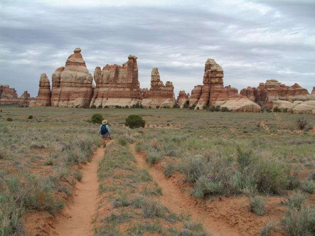
Those of us remaining decided to hike to Chesler Park. Here we are on the trail. Literally.
Here we are a few miles later. Still on the trail. Literally.
In the desert, romance is where you can find it.
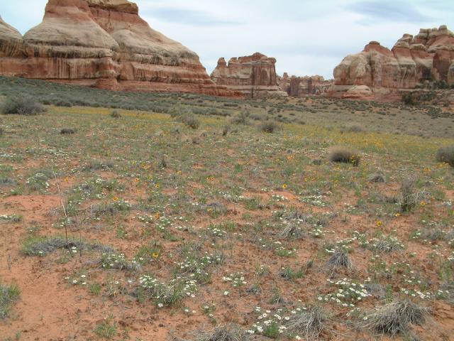
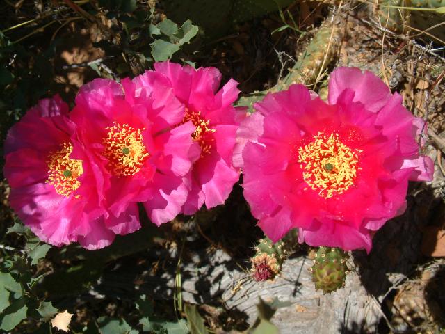
The flowers were out in Chesler Park.
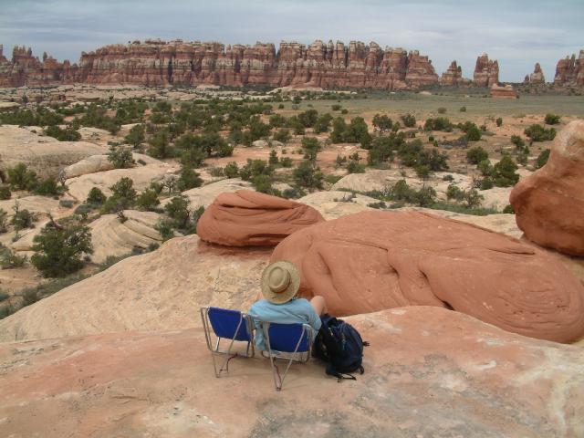
We deployed the Sling-Lights and enjoyed the view before heading back to camp.
We missed the left turn to the Elephant Hill trailhead, and continued on the main trail for a mile or two before we became convinced that we were not going back the way we had come. We turned around and headed back and found the missed turn, and finally got back to the car. Turns out that if we had kept going we would have gotten to the campground.
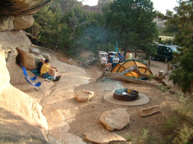
Camp, sweet camp.
As we were leaving the Needles District with Jack and Ruth, we stopped for a short hike and saw some Anasazi ruins and lots of flowers. Unfortunately, we also saw the following:
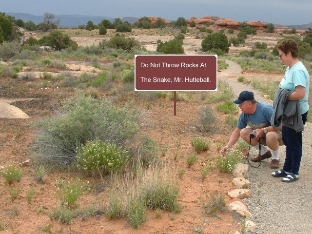
Sad to report that we did, indeed, witness the normally kind and docile Mr. Hutteball engaged in prohibited, alarming, and malevolent behavior in Canyonlands National Park. Yes, he was actually throwing rocks at the defenseless, and no doubt terrified, snake seeking refuge in the bush. More shocking is the fact that Mrs. Hutteball seemed to be encouraging this activity. We can only surmise that this behavioral aberration was brought about as the result of these normally upstanding individuals hanging around with notorious "No Trace Jim" from the nearby Land of AZ.
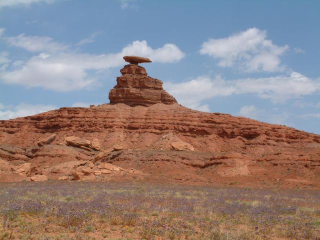
Nonetheless, we proceeded toward the booming metropolis of Mexican Hat, home of a real nice gas station with cheap T-shirts. After a bit of shopping, we proceeded to the Mexican Hat rock itself:
We next headed to the Goosenecks of the San Juan State Park, where Jack put together a real luncheon spread as we enjoyed the view and chatted with some locals.
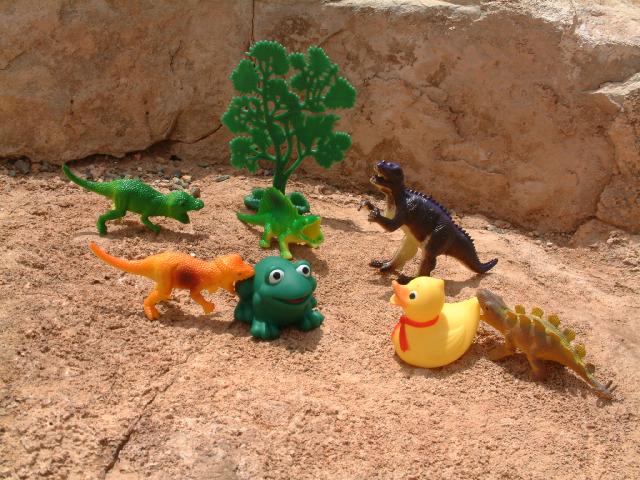
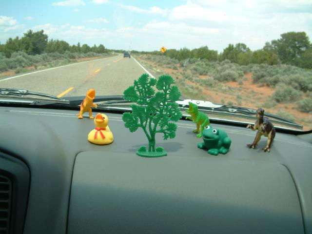
The picnic area was the scene of one of the most gruesome things we saw on the whole trip: the dinosaurs we bought at the Mexican Hat gas station turned on Conner and Roanoke. Here you can clearly see Conner getting a bite on his hind leg, and Roanoke enduring a bit of tail-chewing. We immediately broke it up, but suspected that we would need to keep an eye on things for the rest of the trip.
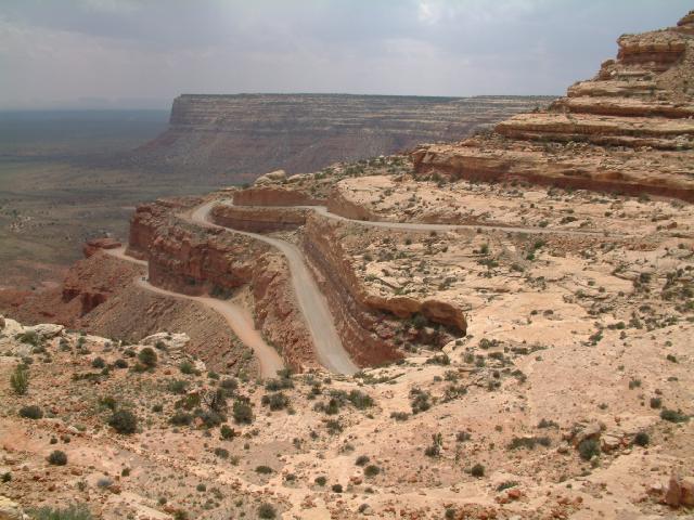
We proceeded up the Mokie Dugway, and were once again amazed that anyone would decide to build a road up the side of the cliff.
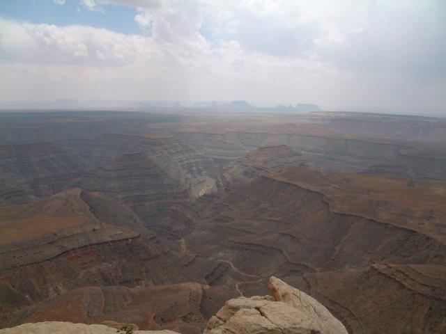
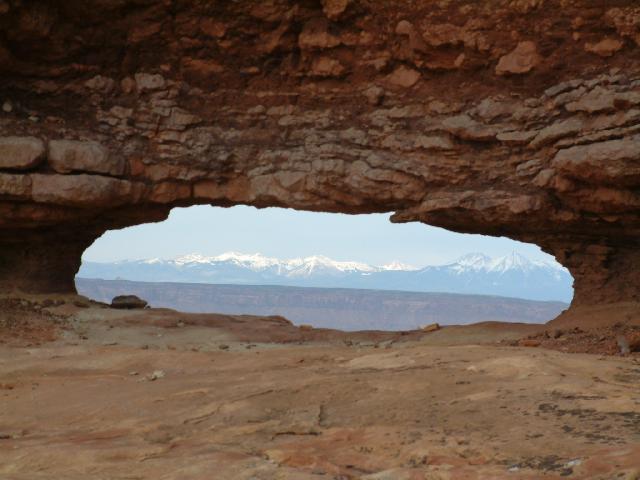
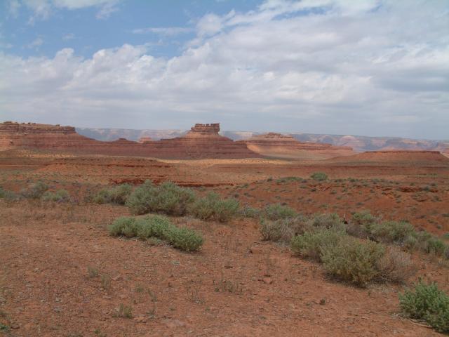
This is the view from Muley Point. We vowed that we would return and spend a night camping here. Monument Valley can be seen in the hazy distance.
Happily, whatever caused the lunch-time ugliness was soon put aside, and we all enjoyed a peaceful drive up to Natural Bridges National Park (although we were stuck behind a big old green Ford Expedition most of the way), where we peeked down from the viewpoints and did some serious shopping at the Visitor's Center.
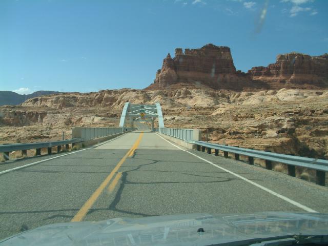
We stopped for gas at Fry Canyon then blasted up to Hite Marina and Heyduke's blue bridge over the Colorado River, on which we spotted Jack and Ruth - that's them by the railing on the left. We had mentioned to them that if they simply drove across the bridge and didn't walk across it, then the entire trip would not count for them. We're still not sure what we meant by that, but sure 'nuff, there they were walking across the bridge. We were surprised, and somewhat alarmed, to see how much attention they appeared to pay to what we said.
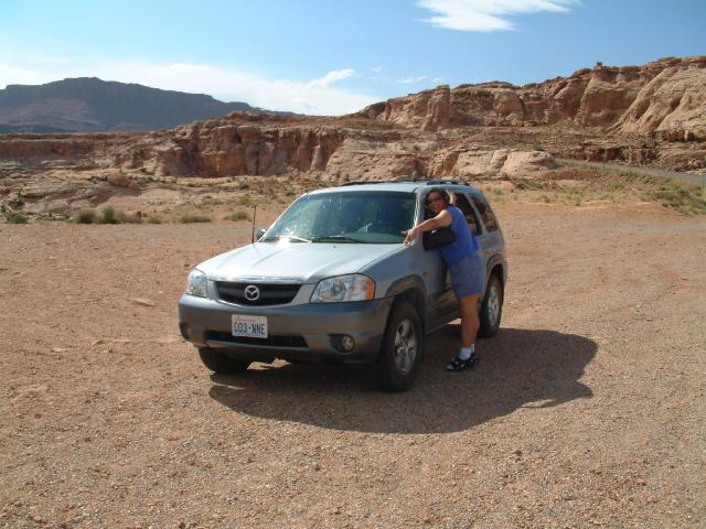
Sue gives the Mazda a well-earned big hug. Note the very tip of the aggressive, yet subtle, dorsal fin barely visible over the roof.
We continued north to Hanksville, where we were dismayed to find that "Stan's Burger Shak" had undergone extensive remodeling (it is now just "Stan's", and includes Stan's new adjacent Chevron gas station and deli) thereby losing all of it's former tacky charm. Then onward through Capitol Reef National Park and to the small town of Torrey, where we moved into 3 rooms at the splendid Super 8 Motel, and then back to Capitol Reef for a less than impressive sunset. The next day we set out moderately early, determined to either get in a full day's hiking or drive the much touted Cathedral Valley Dirt Road Loop. We opted for the latter, and visited the Temples of the Moon and Sun, and...
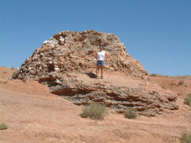
the mysterious Glass Mountain, which turned out to be a mound of pure gypsum that kind of looked like chunks of glass all stuck together in mud.
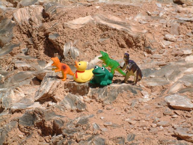
We let the kids and their new friends climb around on Glass Mountain for a while.
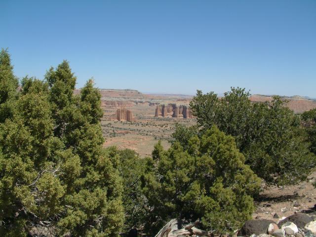
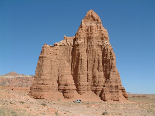
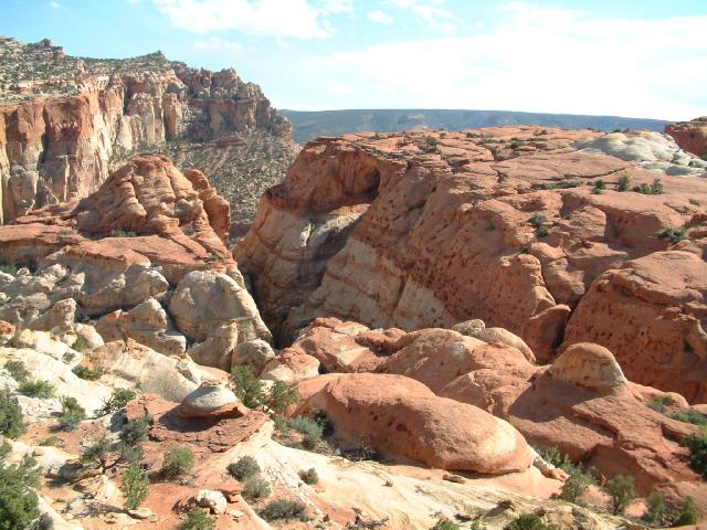
A view down into Cathedral Valley.
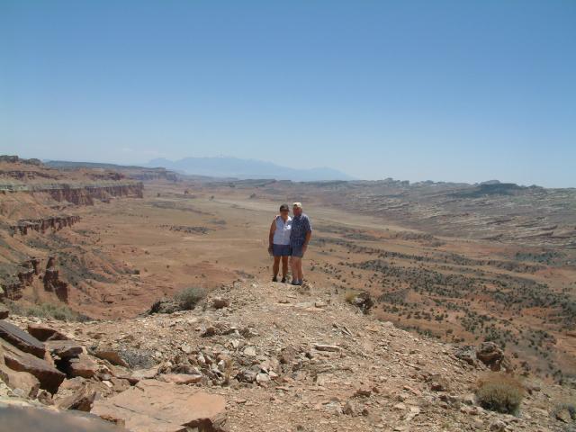
We walked out along an outcropping, from which we enjoyed the view.
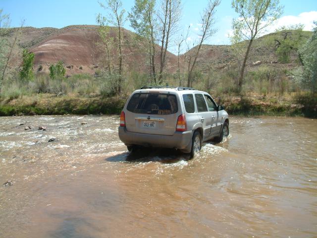
We splashed our way across the Fremont River, and headed back to Capitol Reef for some more hiking.
We first hiked up to Cassidy Arch, which was actually more of an elbow-shaped tunnel with the top opening facing up and the bottom opening on the face of the cliff.
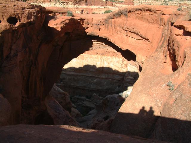
This is the view looking down through the arch from the top.
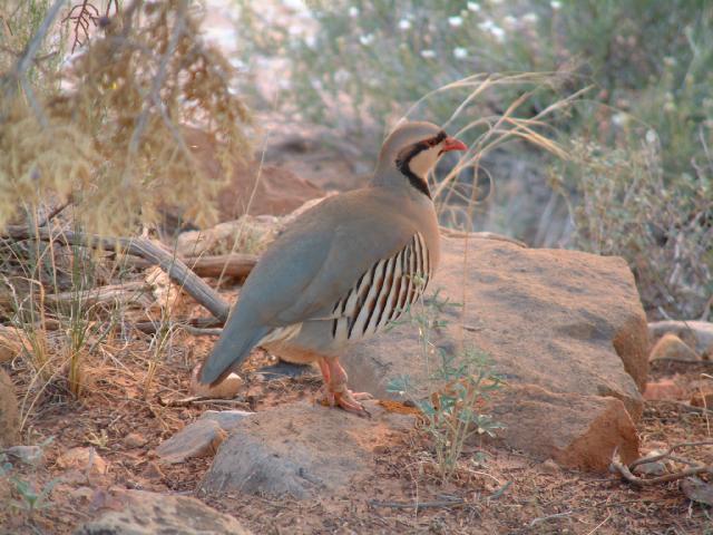
We saw a few of these weird birds as we got back down to the trailhead, then
we hiked
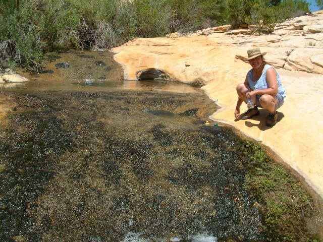
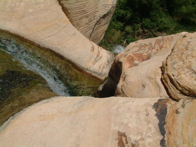
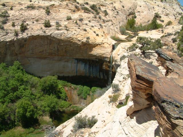
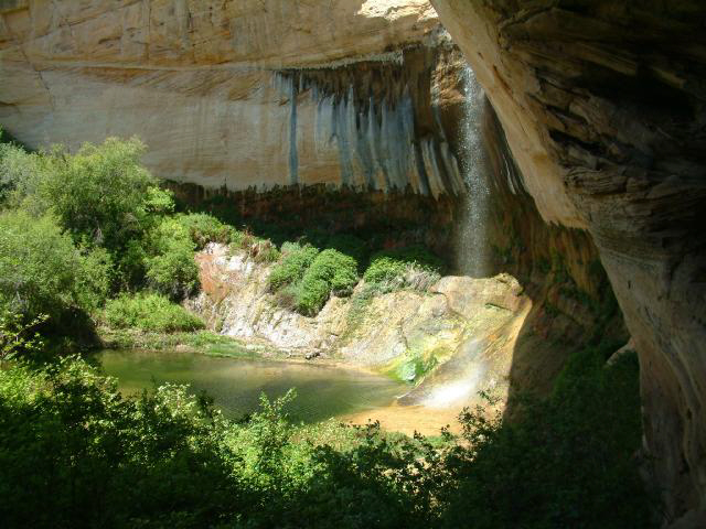
up to The Tanks. The next morning we pulled out of Capitol Reef, and
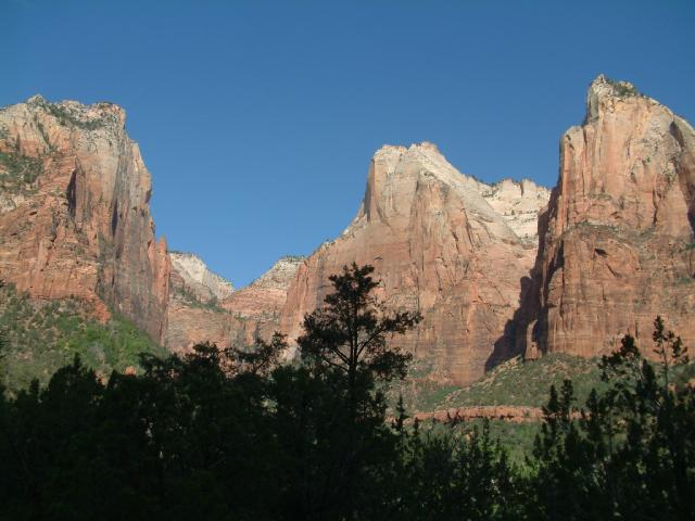
headed down Highway 12 - one of the finest roads in North America. We all
met up at the Anasazi State Park Museum in Boulder.
![]()